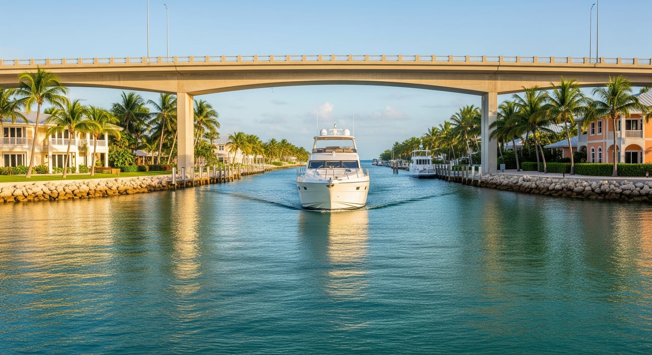
Will your boat clear the bridges into Duck Key, or will you need to dock elsewhere? If you are buying, selling, or simply visiting by water, knowing your true bridge clearance and access options can save time, money, and stress. Duck Key sits in a beautiful but shallow marine environment where tides, chart datums, and local rules matter. In this guide, you will learn how to verify bridge heights and channel depths, where to access services, and what to check if you are evaluating a waterfront property. Let’s dive in.
Bridge clearance basics
Understanding a few key terms helps you plan with confidence. Vertical clearance is the distance from the water’s surface to the underside of a bridge. Your boat’s air draft is the height from the waterline to the tallest fixed point. You pass safely only when the actual clearance is greater than your air draft plus a safety margin.
Charted bridge clearances are tied to a tidal datum, often a high-water reference. Actual clearance at transit time will vary with the tide. Tides in the Middle Keys are modest but still important when your margin is tight. Horizontal clearance is the navigable width under or around a bridge opening and matters for wider vessels.
For official charted information, use the NOAA Office of Coast Survey chart viewer. For tide predictions and datum details, check NOAA Tides & Currents.
Verify your clearance step by step
Measure your air draft
Record the height to your highest fixed point, such as a mast, radar, or hardtop. Include antennas or add-ons that do not fold. Add a safety buffer of at least 1 to 2 feet to account for wave action, wake, and boat squat.
Find official bridge data
Pull the latest nautical chart that covers Duck Key and the approach you plan to use. Bridges and aids to navigation are charted on NOAA’s charts. For highway bridges, confirm published clearances in the Florida Department of Transportation database by searching the FDOT site. Before you go, review the U.S. Coast Guard’s Local Notice to Mariners for any temporary restrictions, construction, or lighting issues that could affect passage.
Adjust for tides and conditions
Check the tide prediction for your planned transit window using NOAA Tides & Currents. If the bridge clearance is referenced to a high-water datum and the actual tide is lower, you may gain clearance. If the tide is higher, you may lose clearance. Recheck just before you go and keep your safety margin conservative.
Plan your safest transit
If your margin is slim, choose the lower tide, slow to minimize squat, and be ready to turn around if conditions change. Confirm horizontal clearance is adequate for your beam. When in doubt, call the local marina for current, practical guidance. Local operators often know where shoaling or wind-driven water can change the picture.
Duck Key boating access at a glance
Duck Key offers resort and marina amenities on-island and more extensive services in nearby Marathon. For slips, fuel, and local guidance, the primary on-island contact is Hawk’s Cay Resort & Marina. They can advise on transient slips, fuel availability, and suggested approaches for prevailing conditions. Many owners rely on Marathon for haul-outs and larger-scale repairs.
The Keys feature shallow flats, seagrass, and coral habitats. Channels are marked, but depths can shift after storms. Always consult updated NOAA charts, the Coast Guard’s Local Notice to Mariners, and local marina staff before transiting unfamiliar cuts.
Local rules and protected waters
You share these waters with sensitive seagrass, mangroves, and nearby reef habitats. Avoid anchoring on seagrass or coral and follow speed and no-wake signs. Manatee protection zones and boating safety rules are set by the Florida Fish and Wildlife Conservation Commission. Review current guidance at the FWC website and follow on-water signage.
For dock permits, seawall work, or mooring and marine facility rules, start with Monroe County’s Building and Planning resources at the Monroe County government site. Navigation safety updates come through the Coast Guard’s Navigation Center and LNM.
Hurricane season planning
Hurricane season runs from June 1 to November 30. If you plan to keep a boat in Duck Key, confirm marina hurricane policies and your insurance requirements well ahead of any storm. Many facilities require specific tie-up procedures or hauling for forecasted wind thresholds. Monitor official advisories and review local plans through Monroe County resources.
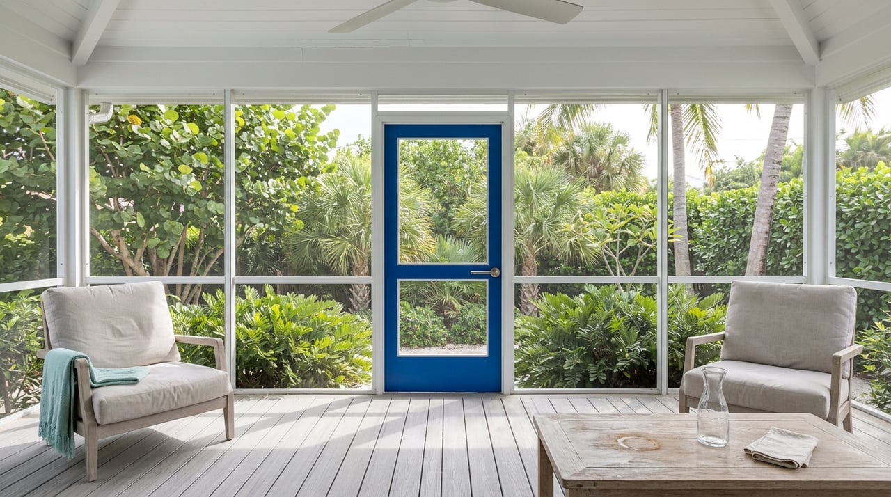
What buyers should verify on Duck Key
If you are evaluating a waterfront or canal-front home, boating access is part of the property’s value. Here is what to confirm early:
- Dock rights and configuration. Determine whether the property has a private dock, a shared or community dock, or access only through a marina or mooring. Verify deeded rights if applicable.
- Current permits. Ask for recorded permits for docks, seawalls, or lifts. Check Monroe County records for any open permits or compliance issues.
- Practical dimensions. Confirm usable dock length, beam limits, and depth at typical low tide against your vessel. For bridge access, compare your air draft to published clearances from FDOT and locations shown on NOAA charts.
- Channel access. Identify the route to open water and who maintains it. If a private cut serves the property, clarify whether the owner or HOA is responsible for dredging and how often it has been needed.
- Safety and environmental rules. Note local speed zones, manatee areas, and anchoring restrictions per the FWC, as these affect daily boating routines and guest usage.
- Insurance considerations. Ask your insurer how the dock type, lift, and storm plan affect premiums. Consider flood insurance for structures near the water.
- Long-term factors. Sea level trends and storm frequency can change practical clearances over time. Favor adaptable dock and lift options when possible.
What sellers can prepare
A well-documented boating story can help buyers picture life on the water and reduce back-and-forth during inspections. Gather and share:
- Permitted dock and lift plans, plus any engineering or maintenance records.
- Recent depth checks or notes from marina staff about the approach at lower tides.
- Any HOA or association documents related to dredging responsibilities and fees.
- Slip agreements or membership details if the property relies on a marina.
- Clear disclosures on any restrictions or pending permits.
Quick checklists
Buyer checklist for waterfront property
- Obtain a recent printout or screenshot of the area from NOAA charts.
- Pull nearby US 1 bridge clearance data via FDOT.
- Ask for dock permits, dredging history, and dock dimensions including depth at low tide.
- Compare your vessel’s length, beam, and air draft against the dock and bridge realities.
- Confirm local marina services, hurricane policy, and haul-out options.
- Verify any mooring or docking rules, dues, or assessments.
- Consider a marine survey or a local captain for a site visit transit.
Boater checklist for a Duck Key transit
- Measure air draft including antennas.
- Review NOAA charts and get tide predictions from NOAA Tides & Currents.
- Check the Coast Guard Local Notice to Mariners for hazards or work zones.
- Call your destination marina for approach guidance and recent depth observations.
- Watch weather and plan a conservative safety margin.
- Confirm safety gear, VHF radio readiness, and paper or digital charts.
Where to get authoritative info
- Official charts and ENC data: NOAA Office of Coast Survey
- Tide predictions and datums: NOAA Tides & Currents
- Notices to Mariners and navigation safety: USCG Navigation Center
- Florida bridge information and clearances: FDOT
- County permits and local marine rules: Monroe County
- Boating safety, speed zones, manatee guidance: Florida Fish and Wildlife Conservation Commission
- Local slips, fuel, and on-island advice: Hawk’s Cay Resort & Marina
Find the right fit for your boat and lifestyle
If boating is part of your Keys plan, you deserve a property that matches your vessel without compromise. From verifying bridge clearances and dock permits to coordinating local experts, you can lean on a boutique advisor who understands both lifestyle and logistics. If you are exploring Duck Key or nearby Middle Keys waterfront options, connect with Tracy Chacksfield to start a thoughtful, well-informed search.
FAQs
How do I know if my boat will fit under Duck Key bridges?
- Measure your air draft, get the bridge’s published vertical clearance from FDOT or NOAA charts, check the tide with NOAA Tides & Currents, and add at least 1 to 2 feet of safety margin.
Where can I find official bridge clearance numbers near Duck Key?
- Use the Florida bridge inventory via FDOT and confirm bridge markings on NOAA charts; check the Coast Guard’s Local Notice to Mariners for temporary changes.
Are there moorings, or do I need a private dock on Duck Key?
- The Keys have both private docks and mooring options; availability and rules vary, so verify with Monroe County resources and contact local marinas such as Hawk’s Cay Resort & Marina for current details.
Who is responsible if a private approach channel to my dock shoals?
- Responsibility can rest with the property owner, an HOA, or a community group, while public channels are managed by agencies; confirm in property records and association documents.
What environmental rules should I expect when boating around Duck Key?
- Avoid anchoring on seagrass or coral, follow posted manatee and no-wake zones, and review the latest rules and safety guidance on the FWC website.