Thinking about bringing your boat to Key Colony Beach or buying a canal-front home? The depth outside the dock and your route to open water can make or break your plans. You want smooth access, clear guidance on rules, and confidence that your boat will fit the water. This guide gives you a simple way to verify depths, understand access and regulations, and plan smart as a buyer or seller. Let’s dive in.
Why canal depth matters
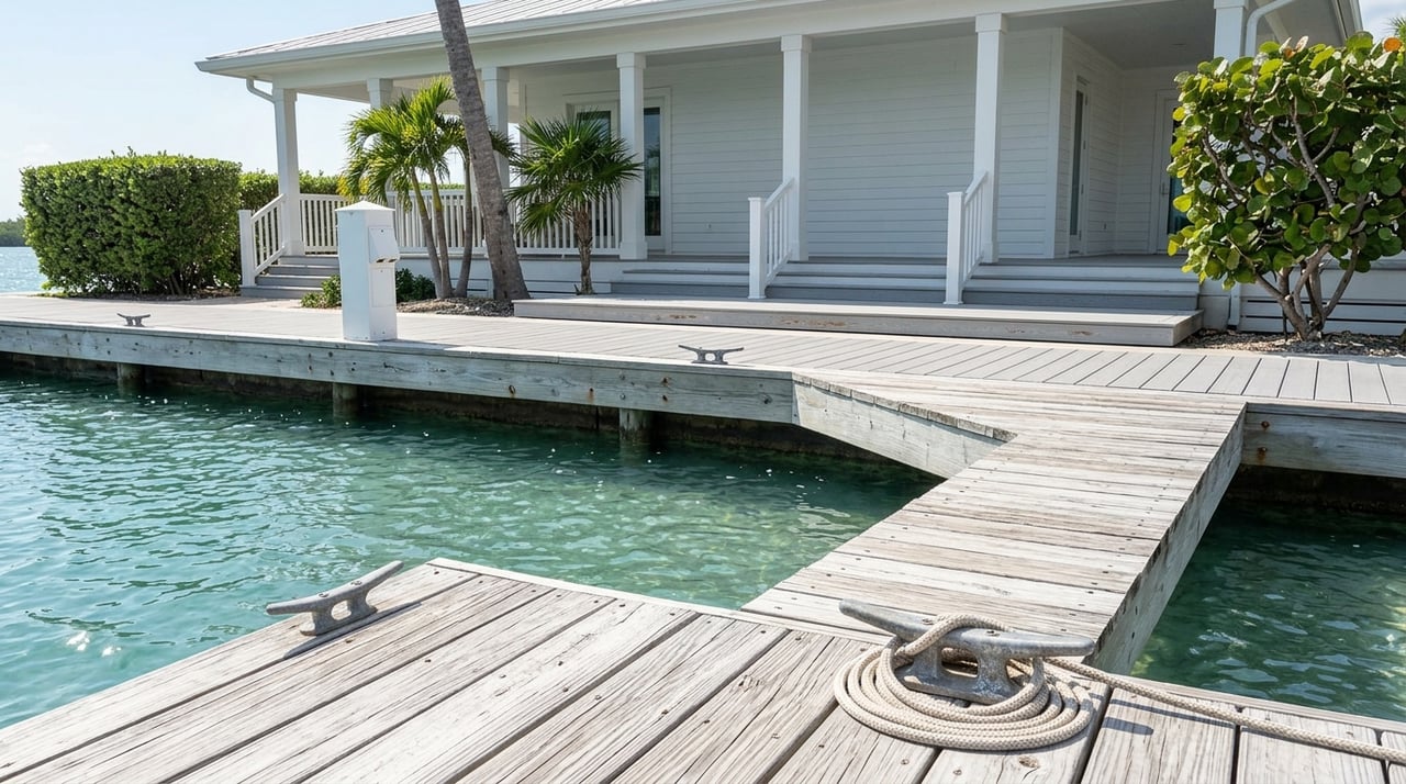
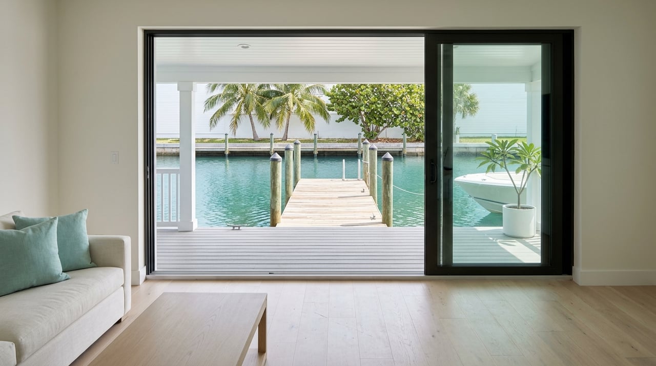
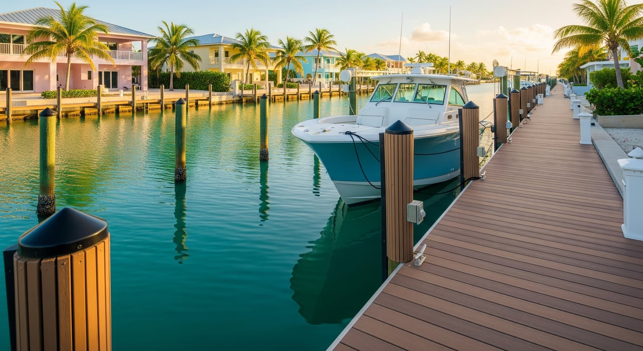
Canal depth influences daily boating, property value, and resale appeal. If the canal is too shallow for your boat at low tide, you may face limited use or a need to time transits carefully. Depth also affects the type of dock or lift you can install and the routes you can safely take to the ocean or bay.
In the Middle Keys, canal conditions change over time. Storms can cause shoaling, while local maintenance can improve access in certain segments. Because conditions vary block by block, your best move is to verify depth and regulations before you commit.
How to verify canal depths
Depths on paper are a starting point. Actual water under your keel depends on the map’s datum, today’s tide, recent shoaling, and your boat’s draft. Use the steps below to get a full picture.
NOAA charts and tides
Start with NOAA nautical charts for the Key Colony Beach and Marathon area. Charts show soundings relative to a tidal datum, typically Mean Lower Low Water. Read the chart legend so you know the reference. You can browse official chart products through the NOAA nautical charts portal.
Next, adjust for tide. Tidal ranges in the Florida Keys are generally modest, often around 1 to 2 feet, but wind and pressure can move water levels up or down. Check the closest station before you transit. The NOAA tide station at Vaca Key, Marathon provides predictions you can use to calculate under-keel clearance at your planned time.
On-water checks
Nothing beats a real reading. Bring a depth sounder and confirm depths at or near low tide, or plan with enough margin for safety. Go slow, note any shoaling at turns, and mark your safe line on a chartplotter for repeat trips.
Local knowledge is valuable. Ask nearby marinas or neighbors about recent changes, submerged hazards, or tight spots. If you are buying and your boat has a deeper draft, consider hiring a licensed surveyor or marine contractor to produce a simple bathymetric check of your frontage and the route to open water.
Local records and permits
Canal depths can be influenced by past dredging or maintenance. The Town of Key Colony Beach and Monroe County may have permit files, bathymetric data, or dredging records for certain areas. State and federal agencies keep permitting records for in-water work as well. If exact clearance is critical, request available records and compare them with recent sonar readings.
Navigating access and regulations
Key Colony Beach canals are primarily residential accessways. Treat them like narrow streets on the water, and plan your route with care.
Public ramps and private docks
If you are trailering, look for public ramps and municipal marinas in the Marathon area. Check Monroe County and Florida Fish and Wildlife Conservation Commission directories for locations and hours. Do not assume public docking is allowed at private seawalls or docks. If you need short-term tie-up, coordinate with a marina in advance.
Speed limits and manatee zones
Expect idle-speed or no-wake rules inside residential canals, with enforcement by county and state authorities. Manatee protection zones and seasonal slow-speed areas are designated by the Florida Fish and Wildlife Conservation Commission. Before you head out, review current maps and guidance on the FWC boating page.
Anchoring, seagrass, and sanctuary rules
Large portions of Keys waters are within the Florida Keys National Marine Sanctuary. Anchoring rules protect sensitive habitats like seagrass. Use designated moorings where available and anchor only on suitable bottom. Check current regulations and maps on the Florida Keys National Marine Sanctuary site.
Navigation aids and safety
Some channels are marked with aids to navigation. Always confirm marker meaning on your NOAA chart and monitor VHF Channel 16 for safety hails. Keep fenders handy and allow space for neighboring boats in narrow stretches.
Property and permitting considerations
If you own or plan to buy a canal-front property, factor in docks, lifts, seawalls, and flood risk. These items carry costs, timelines, and permitting steps.
Docks, seawalls, and dredging
Most dock work, seawall repairs, boat lifts, and any dredging require municipal and county approvals. If work occurs in navigable waters or affects submerged lands or wetlands, state and federal agencies may also be involved. Environmental review and mitigation are common for dredging. These permits can take time and may add cost, so build that into your plan and contract timelines.
If a canal has shoaled, verify who is responsible for maintenance and whether previous dredging has occurred. In some cases it is a private responsibility; in others, a broader maintenance program may exist. Always confirm before you budget.
Flood zones, elevation, and insurance
Much of Key Colony Beach sits in coastal flood hazard zones. FEMA Flood Insurance Rate Maps identify areas such as AE or VE zones, which influence design standards and insurance. Ask for an elevation certificate and get quotes for wind and flood coverage if you are buying. You can view current maps on the FEMA Flood Map Service Center.
Title, easements, and riparian rights
Have your title team review riparian rights, dock-use easements, and any shared maintenance agreements for common canals or seawalls. Clarify vessel-size restrictions, dock dimensions, and piling heights with local authorities before you commit to dock upgrades.
Buyer checklist: canal-front due diligence
Use this quick list to keep your purchase on track:
- Verify depth at your frontage and along the route to open water with a depth sounder at or near low tide.
- Review NOAA charts and apply tide predictions from the nearest station to check under-keel clearance.
- Ask the seller for dredging history, permits, and any HOA or shared maintenance agreements.
- Confirm that existing docks, lifts, and seawalls have permits and no outstanding violations with the Town or County.
- Order a bathymetric spot survey if you plan to keep a deeper-draft boat.
- Check FEMA flood zone, request an elevation certificate, and obtain insurance quotes for wind and flood.
- Review any restrictions on vessel size, dock configuration, and piling height.
Seller checklist: prepare your canal-front listing
Give buyers the clarity they need to move forward with confidence:
- Provide recent depth readings at low tide and any available surveys.
- Share dredging or maintenance records and copies of permits for dock or seawall work.
- Note any known shoaling, storm impacts, or planned municipal projects that could affect access.
- Consider a pre-listing bathymetric check and a clean permit history to strengthen buyer trust.
Seasonal and storm considerations
Storms can temporarily change canal conditions through shoaling or debris. After major events, wait for local guidance before resuming normal transits and confirm depths again. During peak season, boat traffic increases. Plan for idle-speed zones and leave extra room around turns and dock entries.
If you keep a boat at your dock, have a storm plan. Review your marina or lift policies, secure lines well in advance, and know how to access your property after a weather event.
A simple canal-depth planning example
Here is a quick way to approach any planned run from a Key Colony Beach canal:
- Chart review. Check a NOAA chart for your route. Note the chart datum and any shallow soundings along the canal and connecting channels.
- Tide check. Open the nearest NOAA tide station for your window, then add or subtract the tide height from the charted depth to estimate real-time water depth.
- Boat draft and margin. Compare the adjusted depth to your boat’s draft. Add a safety margin for waves, heel, or a loaded boat.
- Local check. Ask a nearby marina or neighbor about any recent shoaling or hazards.
- On-water verification. Do a slow run with a depth sounder before committing to a long trip or nighttime arrival.
Quick verification checklist
- Check a NOAA chart for the immediate area and note the chart datum.
- Pull tide predictions for the nearest NOAA station and calculate clearance at your planned transit time.
- Contact the Town of Key Colony Beach and Monroe County permitting offices for any dredging or dock permit history.
- Ask local marinas or neighbors about shoaling and recent storms.
- If buying, order a bathymetric survey and obtain an elevation certificate and insurance quotes.
- Confirm sanctuary anchoring rules and FWC speed or manatee zones before you head out.
How we help you buy or sell with confidence
You deserve clear answers and a smooth path to closing. With a boutique, hands-on approach and deep Middle Keys expertise, you get practical guidance on canal depth, dock and permit questions, and insurance considerations that matter for waterfront value. From coordinating surveys and vendor quotes to pricing with an eye on access and risk, you can expect steady communication and a calm, data-informed process.
If you are comparing canal-front options or planning to list, let’s talk through your goals, your boat, and your timeline. Together, we will map the details so you can move forward with clarity.
Ready to explore canal-front possibilities in Key Colony Beach? Connect with Tracy Chacksfield to schedule a tour or discuss your plan.
FAQs
What is the typical tidal range near Key Colony Beach?
- Tidal ranges in the Florida Keys are commonly around 1 to 2 feet, but local wind and pressure can shift levels. Always confirm with the nearest NOAA tide station before transiting.
How do I verify actual canal depth for a specific property?
- Combine a NOAA chart review, tide predictions from the nearest station, and on-water readings with a depth sounder at or near low tide. For certainty, hire a licensed surveyor to take spot soundings at your frontage and along the route.
Do I need permits to add a lift or dredge a slip in Key Colony Beach?
- Most dock, lift, seawall, and dredging work requires Town and County approvals, and some projects need state or federal permits. Start early and plan for environmental review on dredging.
Are there public boat ramps that serve Key Colony Beach canals?
- Yes, the Marathon area has public ramps and marinas that provide access to nearby channels. Check Monroe County and FWC listings for current locations, fees, and hours before you go.
How do flood zones affect Key Colony Beach waterfront homes?
- Many properties are within FEMA-designated coastal flood zones such as AE or VE, which can influence design standards and insurance. Ask for an elevation certificate and review the property on the FEMA Flood Map Service Center.
What size boat can I keep on a Key Colony Beach canal?
- It depends on measured depth at low tide, your boat’s draft, dock configuration, and any local restrictions. Verify with a bathymetric check, confirm permits for dock work, and review idle-speed rules for safe operations.